In the west of Tajikistan, near the city of Penjikent, there is a beautiful natural complex of Seven Lakes, which amazes everyone with the saturated and ever-changing color of the water. It is also known as Haftkul, which is translated from Tajik in the same way – Seven Lakes. Sometimes there is a toponym Marguzor lakes, which comes from the name of the largest lake. Each lake has its own name: Mizhgon, Soya, Gushor, Nofin, Khurdak, the largest Marguzor and the last Hazorchashma.
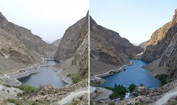
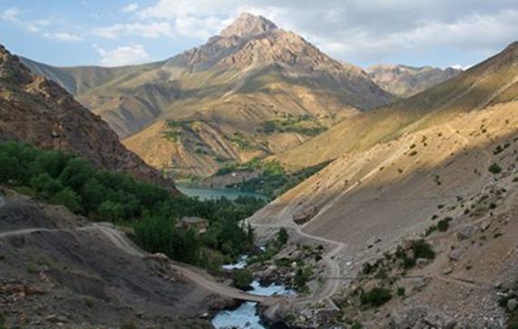
Seven lakes are located in the Fan Mountains, in the gorge of the Shing River. The lowest is at an altitude of 1640 meters above sea level, and the latter at 2400 meters. The total height difference is 760 meters, and the distance between the extreme lakes is more than 14 km, but do not worry – a dirt road passes through all seven lakes, and climbing the serpentines, without taking into account stops, will take no more than an hour. All lakes, except the last Hazorchashma, belong to the overwhelming type of lakes, and appeared due to the disappearance of rock in a narrow gorge. Ancient petroglyphs discovered on the shores of one of them indicate that the lakes are quite old.
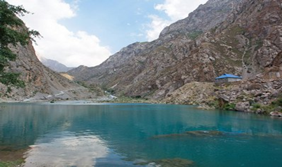
Today, near the Seven Lakes there are several small villages where you can find guest houses for tourists. They are designed very simply and allow you to immerse yourself in the atmosphere of local life. There are fish in four lakes, but rather small – fishing is unlikely to bring much pleasure. And also, it is worth knowing that the lakes are fed by the water of mountain rivers, and therefore become full-flowing by mid-July. In the winter months, in spring and even in early June, the water level is low.
Mizhgon
The first lake that travelers see. Its unusual name is translated from the tajik language as “eyelashes”, although no signs hint at the origin of such a name. Also, there are variations of the name – Nezhegon, Nezhigok, Nezhigon. The height of the lake is 1640 meters above sea level, the depth is up to 20 meters, and the area is 0.05 sq. km.
Water in Nezhigon is distinguished by a palette of colors: depending on the lighting and season, it can be turquoise, blue and even purple. This is due to the strong mineralization of water by sodium and calcium. In summer, the water is quite warm, and you can plunge into this bewitching lake.
Soya
Climbing a steep serpentine, and looking back from a height at Mijgon, travelers will be right on the shore of the second lake – Soya. This toponym is translated from Tajik as “shadow”, and this name is explained by the fact that the lake is located between high cliffs, and almost all day its waters are in shadow.
Water in Soya is similar to water in Nezhigon, it also changes color depending on the weather and time of day. The lake is located at an altitude of 1701 meters above sea level, and the area of the water mirror is 0.1 sq. Km.
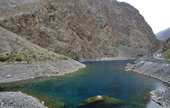
Gushor
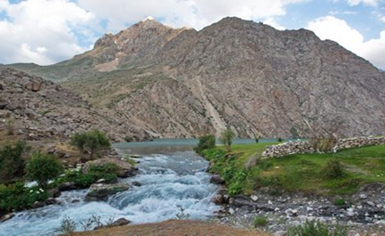
Third, Lake Gushor is located 400 meters from Soya and, rising to it, you can see the stormy stream connecting them. Gushor Lake is located at an altitude of 1771 meters above sea level, and its area is 0.23 square kilometers.
There are consonant names for this lake – Khusher, Ishore, and all of them mean “watchful”. It is surrounded by steep cliffs, and also once there were poisonous snakes, which explains the origin of this name.
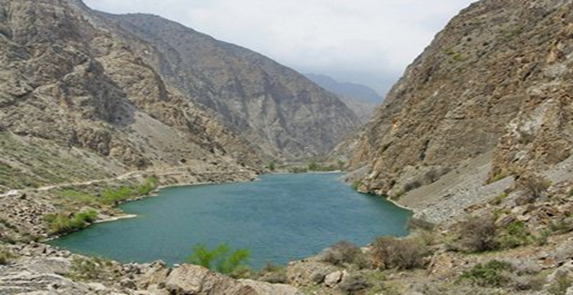
In Soviet times, the Marguzor Lakes camp site was located on the lake, but once a mudflow descended from the mountains, which swept it away, leaving only traces of foundations. All this creates an areola of danger, but the lake looks quite calm and in clear weather you can watch schools of fish swimming calmly in clear water.
Nofin
The distance from Lake Gushor to Lake Nofin is only 400 meters, but the climb along the serpentine is a kilometer. The fourth of the seven lakes has a very elongated shape, and its length exceeds 2.5 km, despite the fact that the average width is 200 meters. Located at an altitude of 1820 meters above sea level, the area of the water mirror is 0.48 sq. Km.
The name of Lake Nofin is translated as “umbilical cord”, and its origin is associated with the fact that it is the central of seven lakes and also very long, similar to the umbilical cord. Locals tell various legends and say that the lake has its secrets. The road runs along the east coast and sometimes floods it in the summer, so cars pass with difficulty. At the far end of the lake is a small village with guest houses.
Khurdak
It is the smallest among all seven lakes. Even his name translates as “baby.” Its area is only 0.025 square kilometers, and it is located at an altitude of 1870 meters. The distance from Lake Nofin is 1.5 km, and along the way you can see the village of Padrut.
Once upon a time, a small hydroelectric power station was located on Khurdak, which provided electricity to the village and the surrounding houses.
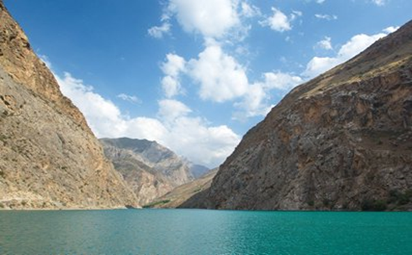
Marguzor
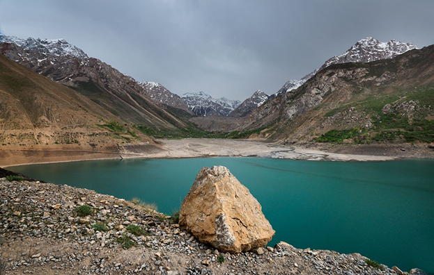
The largest and most beautiful lake in the Seven Lakes system. To get to it, you need to drive more than 2 km along the serpentine and climb to a height of 2140 meters. Its area is 1.16 sq. Km, the length reaches 2.7 km, the maximum depth is 45 meters. The wide expanse of blue water and the majestic mountains in the background create a magnificent landscape.
In the Middle Ages, near the lake, mining of semiprecious stones was carried out. Today at the southern end of the lake is a small village, whose houses are scattered on the surrounding slopes. Locals can tell legends and tales in which Lake Marguzor will appear.
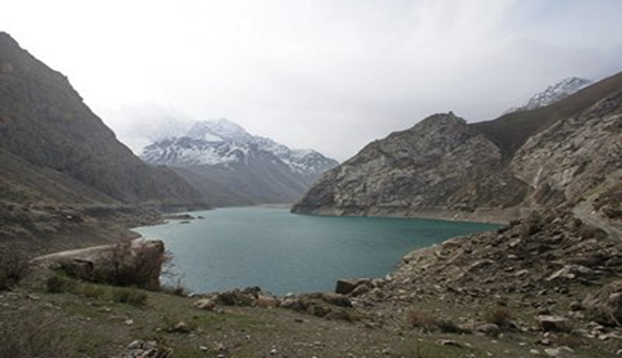
The road through the lake goes along the eastern shore, sometimes almost at water level. During spills, the lake floods the road and can only be reached by truck or a reliable jeep. Also, in the southern part of Marguzor, a trail begins leading to the Tavasang pass (3307 meters), from which you can go on one of the mountain routes along the Fan Mountains.
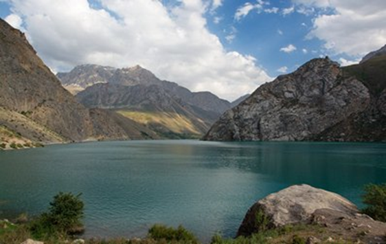
Hazorchashma
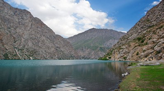
The final and highest mountain lake in the Seven Lakes complex. It is located at around 2,400 meters above sea level. It is also as large as Marguzor, but still somewhat inferior in size: the area of the water mirror is 0.92 square kilometers, and the maximum length is 2 km. The name Hazorchashma or Azorchashma means “thousand springs” – it really feeds on the waters of two rivers and many streams.
This is the last lake in the gorge of the Shing River, and there are no further settlements, the road ends and further only the wildlife of the Fan Mountains. Therefore, you can look at the lake only from the north side. To look from the south side, you will need to go on a mountain hike, bypassing the rocky shores of the lake, but as a reward tourists will get a magnificent view of Hazorchashma, behind which in the distance you can see the waters of Marguzor.